


- NATURE
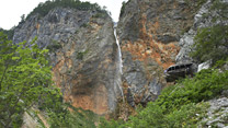
- Waterfalls
- The Logar Valley Trail
- The Savinja river and its tributaries
- Exceptional trees
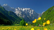
- Alpine flowers
- Animals
- Natural values
- Natura 2000

Hiking and mountaineering
HIKING
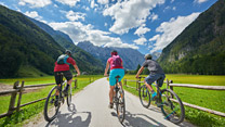
The location of the Logar valley in the heart of the Kamnik-Savinja Alps offers hiking enthusiasts numerous hikes and walks on marked and umarked trails of varying levels of difficulty.
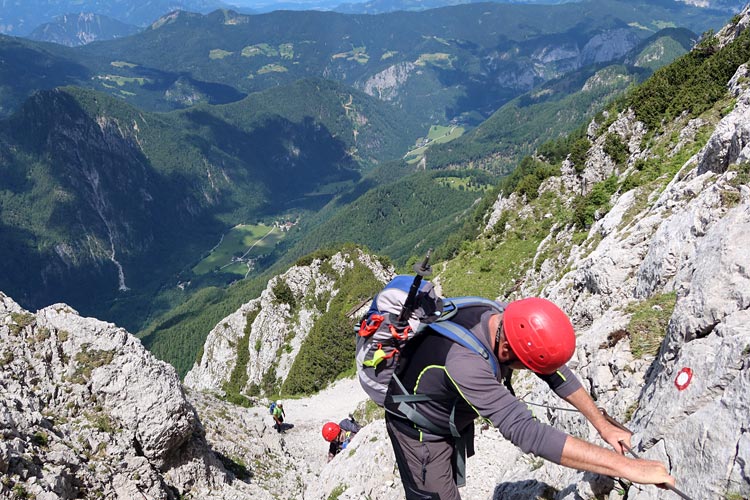
The Logar valley is a popular starting point for conquering a number of 2,000-metre-high peaks, among which the walls of Ojstrica and Planjava stand out above the valley. This is why hiking is well developed and popular in the valley. The most visited destinations are Planinski dom na Okrešlju mountain hut, which is reached on a trail past the Rinka waterfall, and the the Planinski dom na Klemenči jami mountain hut, from where there is a beautiful view of the upper part of the Logar valley.
For inquisitive hikers and walkers, there is a well-kept natural-ethnographic trail through the Logar valley, where you can learn many interesting facts about the connection between people and nature over the centuries.
Mountain huts in the Logar Valley area
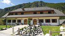
Dom planincev v Logarski dolini (838 m)
● Opened- Address: Logarska dolina 15a, 3335 Solčava
- Coordinates: 46.38371570, 14.62100140
- Website: https://pzs.si/mountain-huts/92
- Weather: Partly cloudy
- Cloud cover: 50 %
- Temperature: 15.6 °C
- Feels like: 15.3 °C
- Humidity: 70 °C
- Wind: 2.7 km/h, West-Southwest
- Visibility: 39 km
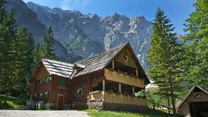
Koča na Klemenči jami pod Ojstrico (1210 m)
● Opened- Address: Logarska dolina 31, 3335 Solčava
- Coordinates: 46.37836790, 14.63386890
- Website: https://pzs.si/mountain-huts/93
- Weather: Partly cloudy
- Cloud cover: 59 %
- Temperature: 13.4 °C
- Feels like: 11.6 °C
- Humidity: 70 °C
- Wind: 8.5 km/h, West-Southwest
- Visibility: 34.7 km
Frischaufov dom na Okrešlju (1393 m)
● Opened- Address: Logarska dolina 16, 3335 Solčava
- Coordinates: 46.36944925, 14.58774785
- Website: https://pzs.si/mountain-huts/91
- Warning: V neposredni bližini novogradnje je postavljeno zavetišče, lesena brunarica, ki je odprta ob vikendih v primeru lepega vremena in v primeru varnih plazovnih razmer. Oskrbnik nudi omejena ponudbo hrane in pijače - prenočišč NI! Najbližje prenočišče je na voljo v Domu planincev v Logarski dolini.
- Weather: Partly cloudy
- Cloud cover: 60 %
- Temperature: 11.1 °C
- Feels like: 8.1 °C
- Humidity: 76 °C
- Wind: 15.7 km/h, South-Southwest
- Visibility: 31.4 km
Kamniška koča na Kamniškem sedlu (1865 m)
● Opened- Address: Kamniška Bistrica 11, 1242 Stahovica
- Coordinates: 46.35914565, 14.59742838
- Website: https://pzs.si/mountain-huts/86
- Warning: SI: Koča je odprta ob lepih koncih tedna - koča je zasilno oskrbovana. Poteka dežurstvo članov PD Kamnik, ki strežejo le pijačo in poskrbijo za toplo jedilnico. Čez teden je možno prenočiti v zimski sobi, ki se nahaja v kletnih prostorih koče. V njej je nekaj ležiš in odej. EN: The hut is open during weekends and holidays in case of nice weather. Only partial service (cold and hot beverages) is provided by members of local Alpine club. The winter room is open out of working hours. It is equipped with some beds and blankets.
- Weather: Partly cloudy
- Cloud cover: 78 %
- Temperature: 6.9 °C
- Feels like: 2.8 °C
- Humidity: 91 °C
- Wind: 20.6 km/h, Southwest
- Visibility: 4.2 km
Zavetišče na Korošici (1809 m)
● Closed- Address: Podveža 47, 3334 Luče
- Coordinates: 46.35565059, 14.63976333
- Website: https://pzs.si/mountain-huts/90
- Warning: POZOR: rezervacija prenočišč ni možna. Pri prenočevanju je obvezna uporaba lastne posteljnine!
- Weather: Overcast
- Cloud cover: 91 %
- Temperature: 6.3 °C
- Feels like: 1.9 °C
- Humidity: 98 °C
- Wind: 23.5 km/h, Southwest
- Visibility: 260 m
Last update: 20.10.2026 14:00
MARKED MOUNTAIN TRAILS FROM THE LOGAR VALLEY
The Logar Valley Trail
● Technically easy- Starting point: Logar Valley - several different starting points are possible (e.g. Izvir Črne: 46.410004, 14.637114)
- Finish point: circular route
- Distance: 7 km
- Walking time (one way): 2 - 3 h
 The Logar Valley Trail brochure
Logar Valley (Na razpotju) - Koča na Klemenči jami
● Technically easy- Starting point: Logar Valley (Na razpotju) (781 m) (46.392086, 14.627438)
- Finish point: Koča na Klemenči jami (1.210 m) (46.378198, 14.633902)
- Distance: 2,09 km
- Walking time: 1 h 20 min
- Walking time back:: 1 h
- Ascent: 431 m
- Descent: 1 m
- Type of ground: Path ~73 %, Forestry road ~27 %
Logar Valley (Na razpotju) - Plesnikova planina - Strelovec
● Technically easy- Starting point: Logar Valley (Na razpotju) (781 m) (46.392086, 14.627438)
- Finish point: Strelovec (1.764 m) (46.394400, 14.658189)
- Distance: 5,68 km
- Walking time: 3 h 25 min
- Walking time back:: 2 h 35 min
- Ascent: 1.055 m
- Descent: 73 m
- Type of ground: Path ~64 %, Bad path ~10 %, Bad track ~8 %, Asphalt road ~8 %, Forestry road ~5 %, Track ~3 %, Macadam road ~2 %
Logar Valley (Dom planincev) - Koča na Klemenči jami
● Technically easy- Starting point: Logar Valley (Dom planincev) (838 m) (46.383652, 14.621160)
- Finish point: Koča na Klemenči jami pod Ojstrico (1.210 m) (46.378198, 14.633902)
- Distance: 1,68 km
- Walking time: 1 h 10 min
- Walking time back:: 55 min
- Ascent: 383 m
- Descent: 9 m
- Type of ground: Path ~70 %, Forestry road ~30 %
Logar Valley (Dom planincev) - Klemenča jama - Strelovec
● Technically easy- Starting point: Logar Valley (Dom planincev) (838 m) (46.383652, 14.621160)
- Finish point: Strelovec (1.764 m) (46.394400, 14.658189)
- Distance: 5,04 km
- Walking time: 3 h 10 min
- Walking time back:: 2 h 25 min
- Ascent: 972 m
- Descent: 47 m
- Type of ground: Path ~88 %, Forestry road ~10 %, Asphalt road ~1 %, Macadam road <1 %, Walking path <1 %
Logar Valley (Na razpotju) - Klemenča jama - Strelovec
● Technically easy- Starting point: Logar Valley (Na razpotju) (781 m) (46.392086, 14.627438)
- Finish point: Strelovec (1.764 m) (46.394400, 14.658189)
- Distance: 5,33 km
- Walking time: 3 h 20 min
- Walking time back:: 2 h 30 min
- Ascent: 1.019 m
- Descent: 37 m
- Type of ground: Path ~90 %, Forestry road ~10 %
Logar Valley (Na razpotju) - Klemenča jama - Krofička
● Difficult- Starting point: Logar Valley (Na razpotju) (781 m) (46.392086, 14.627438)
- Finish point: Krofička (2.083 m) (46.374539, 14.645039)
- Distance: 4,72 km
- Walking time: 3 h 55 min
- Walking time back:: 2 h 50 min
- Ascent: 1.311 m
- Descent: 8 m
- Type of ground: Path ~60 %, Bad path ~28 %, Forestry road ~12 %
Logar Valley (Dom planincev) - Klemenča jama - Krofička
● Difficult- Starting point: Logar Valley (Dom planincev) (838 m) (46.383652, 14.621160)
- Finish point: Krofička (2.083 m) (46.374539, 14.645039)
- Distance: 4,43 km
- Walking time: 3 h 50 min
- Walking time back:: 2 h 45 min
- Ascent: 1.264 m
- Descent: 17 m
- Type of ground: Path ~56 %, Bad path ~30 %, Forestry road ~12 %, Asphalt road ~1 %, Macadam road <1 %, Walking path <1 %
- Danger: The slopes are steep and grassy, so it can be slippery when wet. The top part is rocky, so a helmet is required.
- Equipment required: hiking equipment and helmet
Logar Valley (Plesnik) - Plesnikova planina - Klemenča jama
● Difficult- Starting point: Logar Valley (Na razpotju) (781 m) (46.392086, 14.627438)
- Finish point: Koča na Klemenči jami (1.210 m) (46.378198, 14.633902)
- Distance: 5,01 km
- Walking time: 2 h 40 min
- Walking time back:: 2 h 20 min
- Ascent: 668 m
- Descent: 237 m
- Type of ground: UBad path ~42 %, Path ~33 %, Asphalt road ~9 %, Bad track ~6 %, Forestry road ~6 %, Track ~3 %, Macadam road ~2 %
- Warning: Trail has safety gear.
Logar Valley (Na razpotju) - Škarje - Planjava
● Difficult- Starting point: Logar Valley (Na razpotju) (781 m) (46.392086, 14.627438)
- Finish point: Planjava (2.394 m) (46.356529, 14.613768)
- Distance: 7,24 km
- Walking time: 5 h 30 min
- Walking time back:: 4 h 10 min
- Ascent: 1.746 m
- Descent: 135 m
- Type of ground: Path ~67 %, Bad path ~26 %, Forestry road ~8 %
- Warning: Trail has safety gear.
Logar Valley (Dom planincev) - Škarje - Planjava
● Difficult- Starting point: Logar Valley (Dom planincev) (838 m) (46.383652, 14.621160)
- Finish point: Planjava (2.394 m) (46.356529, 14.613768)
- Distance: 6,83 km
- Walking time: 5 h 20 min
- Walking time back:: 4 h
- Ascent: 1.697 m
- Descent: 143 m
- Type of ground: Path ~65 %, Bad path ~27 %, Forestry road ~7 %
- Warning: Trail has safety gear.
Logar Valley (turning point) - Savinjsko sedlo
● Difficult- Starting point: Logar Valley (turning point) (1.010 m) (46.369654, 14.598524)
- Finish point: Savinjsko sedlo (1.999 m) (46.375034, 14.566251)
- Distance: 4,21 km
- Walking time: 3 h
- Walking time back:: 2 h 10 min
- Ascent: 1.000 m
- Descent: 10 m
- Type of ground: Path 100 %
- Warning: Trail has safety gear.
Logar Valley (turning point) - Ledinski vrh
● Difficult- Starting point: Logar Valley (turning point) (1.010 m) (46.369654, 14.598524)
- Finish point: Ledinski vrh (2.108 m) (46.375086, 14.559261)
- Distance: 4,99 km
- Walking time: 3 h 25 min
- Walking time back:: 2 h 30 min
- Ascent: 1.121 m
- Descent: 28 m
- Type of ground: Path ~92 %, Bad path ~8 %
- Warning: Trail has safety gear.
Logar Valley (Na razpotju) - Ojstrica (po Kopinškovi poti)
● Very difficult- Starting point: Logar Valley (Na razpotju) (781 m) (46.392086, 14.627438)
- Finish point: Ojstrica (2.350 m) (46.363968, 14.637285)
- Distance: 5,62 km
- Walking time: 4 h 55 min
- Walking time back:: 3 h 30 min
- Ascent: 1.575 m
- Descent: 8 m
- Type of ground: Path ~60 %, Bad path ~30 %, Forestry road ~10 %
- Warning: Trail has safety gear.
- Equipment required: self-belaying equipment
Logar Valley (Na razpotju) - Škarje - Ojstrica
● Very difficult- Starting point: Logar Valley (Na razpotju) (781 m) (46.392086, 14.627438)
- Finish point: Ojstrica (2.350 m) (46.363968, 14.637285)
- Distance: 6,36 km
- Walking time: 5 h
- Walking time back:: 3 h 40 min
- Ascent: 1.628 m
- Descent: 61 m
- Type of ground: Path ~78 %, Bad path ~13 %, Forestry road ~9 %
- Warning: Trail has safety gear.
Logar Valley (Dom planincev) - Škarje - Ojstrica
● Very difficult- Starting point: Logar Valley (Dom planincev) (838 m) (46.383652, 14.621160)
- Finish point: Ojstrica (2.350 m) (46.363968, 14.637285)
- Distance: 5,96 km
- Walking time: 4 h 50 min
- Walking time back:: 3 h 30 min
- Ascent: 1.579 m
- Descent: 69 m
- Type of ground: Path ~78 %, Bad path ~14 %, Forestry road ~9 %
- Warning: Trail has safety gear.
Logar Valley (turning point) - Mrzla gora
● Very difficult- Starting point: Logar Valley (turning point) (1.010 m) (46.369654, 14.598524)
- Finish point: Mrzla gora (2.203 m) (46.377158, 14.578318)
- Distance: 4,69 km
- Walking time: 3 h 45 min
- Walking time back:: 2 h 40 min
- Ascent: 1.213 m
- Descent: 21 m
- Type of ground: Path ~78 %, Bad path ~22 %
- Warning: Trail has safety gear.
Logar Valley (turning point) - Skuta
● Very difficult- Starting point: Logar Valley (turning point) (1.010 m) (46.369654, 14.598524)
- Finish point: Skuta (2.532 m) (46.363262, 14.557849)
- Distance: 5,93 km
- Walking time: 4 h 55 min
- Walking time back:: 3 h 35 min
- Ascent: 1.554 m
- Descent: 36 m
- Type of ground: Path ~63 %, Bad path ~37 %
- Warning: Trail has safety gear.








TIC Logarska dolina
Visitor Information about the Park
Logarska dolina 9, 3335 Solčava, Slovenia
T: +386 (03) 838 9004
E: logarska-dolina@solcava.si
Zavod Logarska dolina
E: info@logarska-dolina.com
TIC CENTER RINKA, Solčava
Tourist Information and Programs,
Exhibitions, Local Products, Local Guides
Solčava 29, 3335 Solčava, Slovenia
T: +386 (0)3 839 07 10
E: info@solcavsko.info
www.logarska-solcavsko.si


 OBČINA SOLČAVA, 2026, All rights reserved